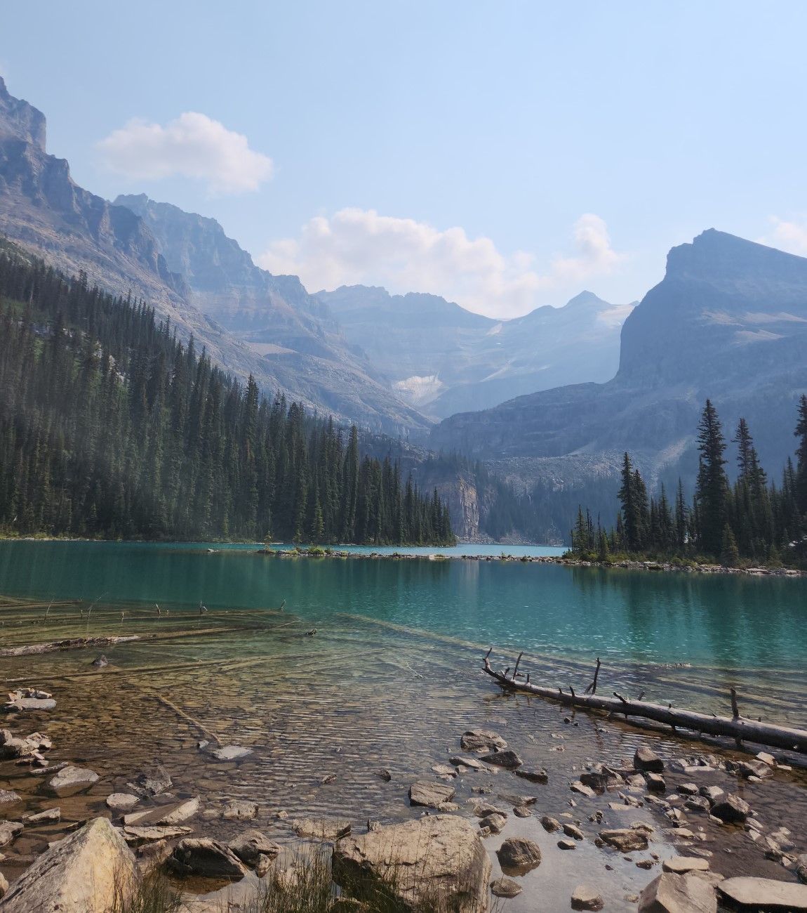
High up in the Canadian rockies, right below that glacier in the center of the picture one can find lake Oesa. The lake in the foreground is Lake O'hara, a hikers paradise. Our journey starts at this side of Lake O'hara where the shuttle bus drops you off after a 11km drive from the highway. Getting a bus ticket to here is a rare event, they are sold out immediately after being released.
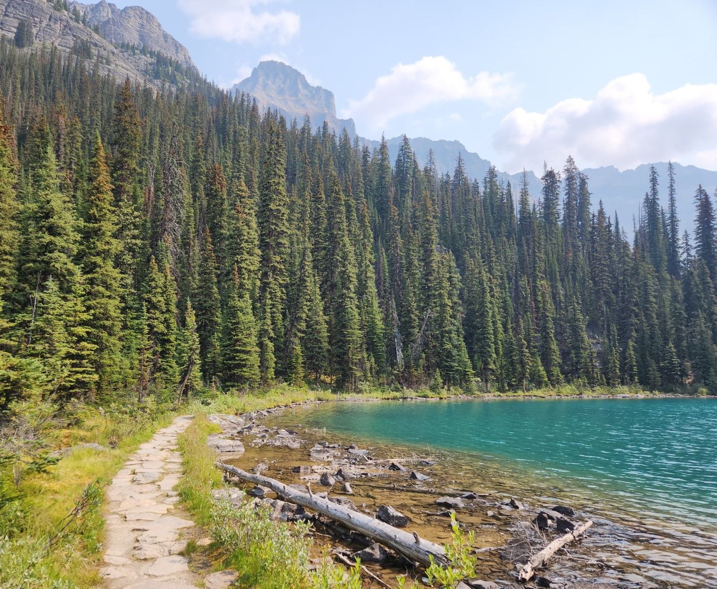
Getting around the lake is simple, the walk is flat and lovely. This is a relatively easy hike, if you want more of a challenge you can head up the Wiwaxy gap and meet up with the trail later. We chose the easy path because it was ten in the morning and almost twelve hours of hiking was ahead of us. If you're just going to lake Oesa and back, it's a 5.8 km hike with 270m of elevation.
Lake O'hara is surrounded by mountains. It's two thousand meters above sea level so the Summer is short. These photos are from August 5th. The Lake is near freezing despite it being the height of the summer.
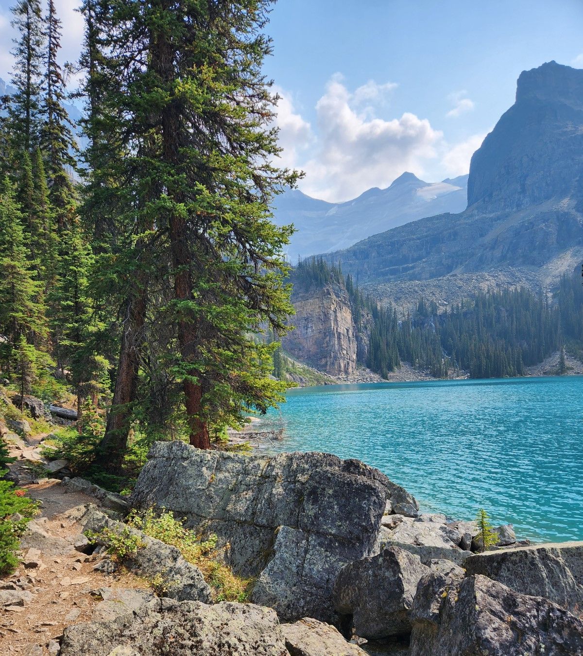
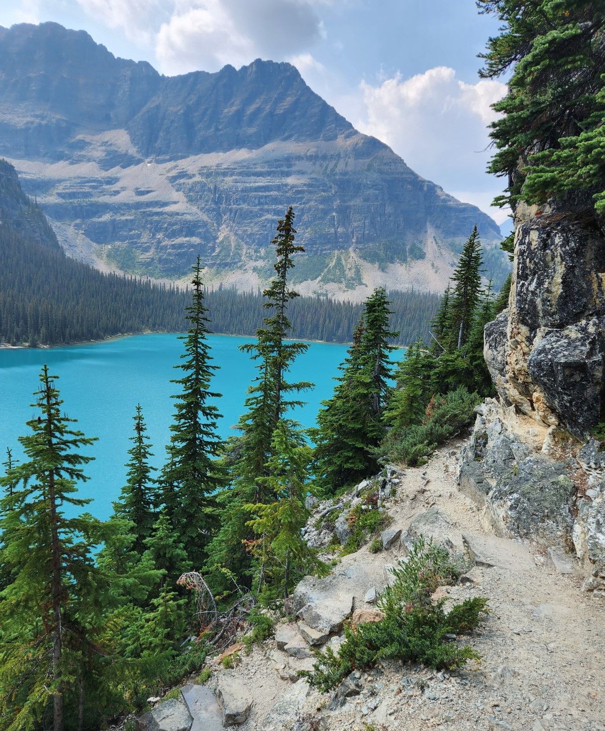
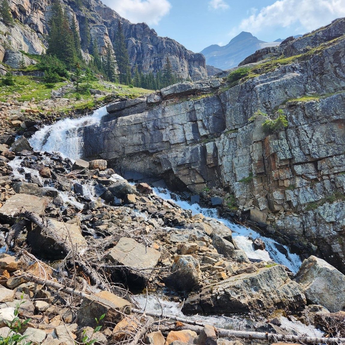
The lake changes colour depending on how the light strikes it. The colours come from minerals which come from the melting glaciers. Such lakes are few and far between. We can also see the waterfall from the stream connecting Lake Oesa with Lake O'hara.
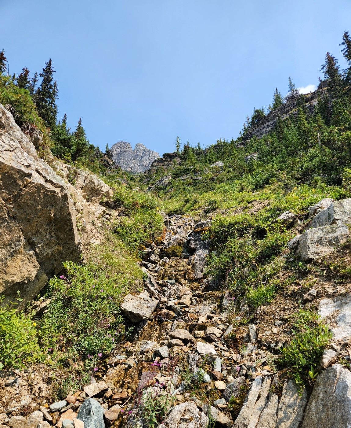
Avalanche chutes or rivulets covered by rocks provide excellent vistas up and down the mountain. This is the start of our ascent. That's not the trail, sometimes you have to take your eyes off the lake and admire mount Huber which is north east of us.
Mount Schaffer is to the south west of Lake O'hara, on the other side is Lake McArthur. We hiked there towards the end of the day.
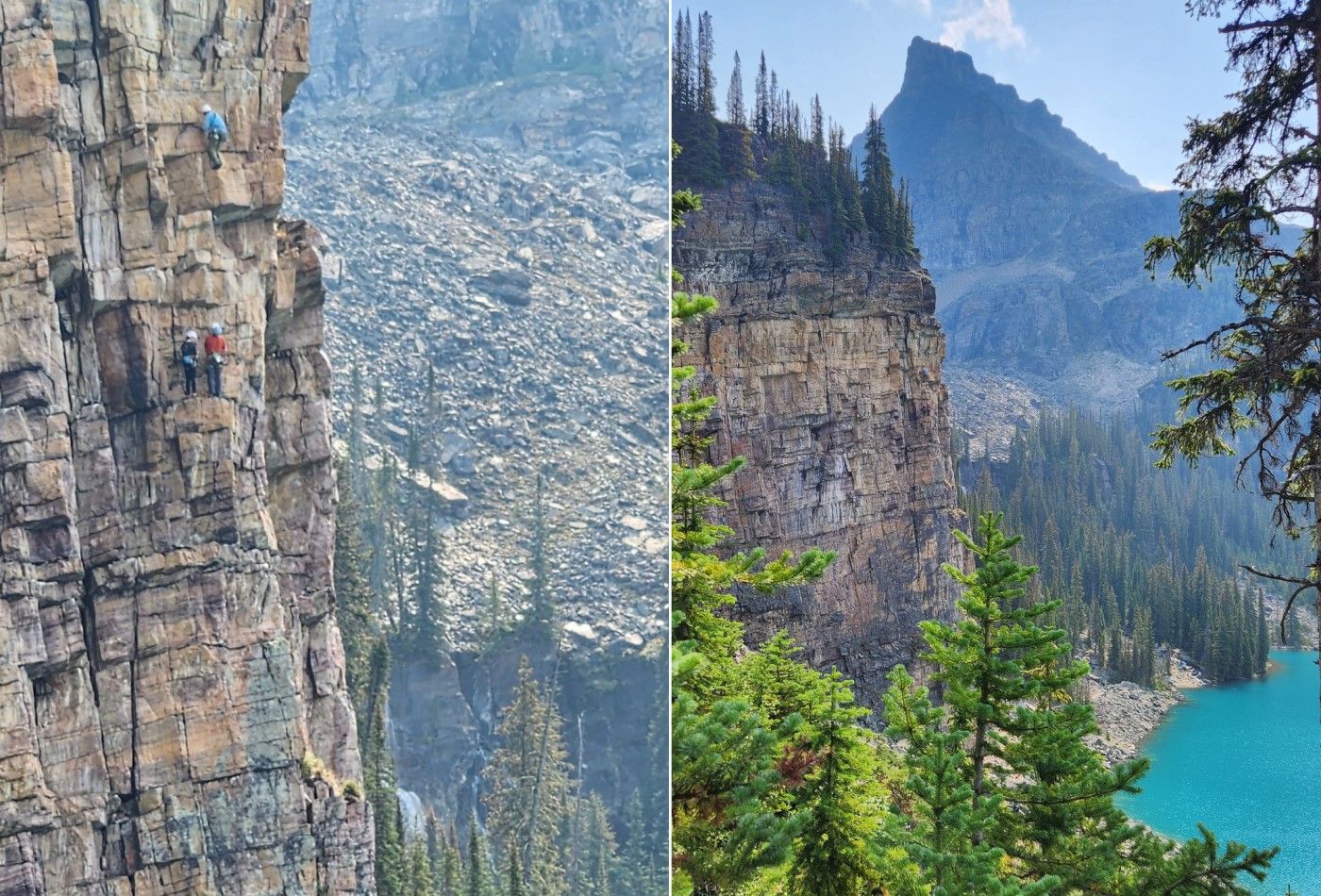
Some people prefer to take the extreme route up to Lake Oesa. It must be an incredible climb with the waterfall to your right and the lake at your back.
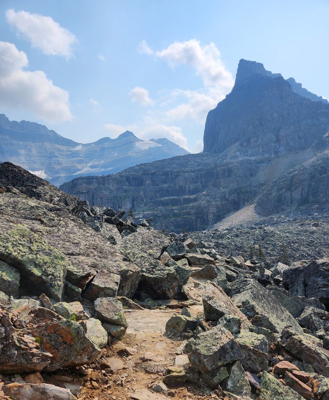
Above the cliff is a rockfield. These hikes are highly rated because they have all sorts of terrain and they ascend up into the alpine zone. Rock fields are formed by avalanches or glaciers. Trees don't have much of an opportunity to grow up here and the soil gets carried down to the lake.
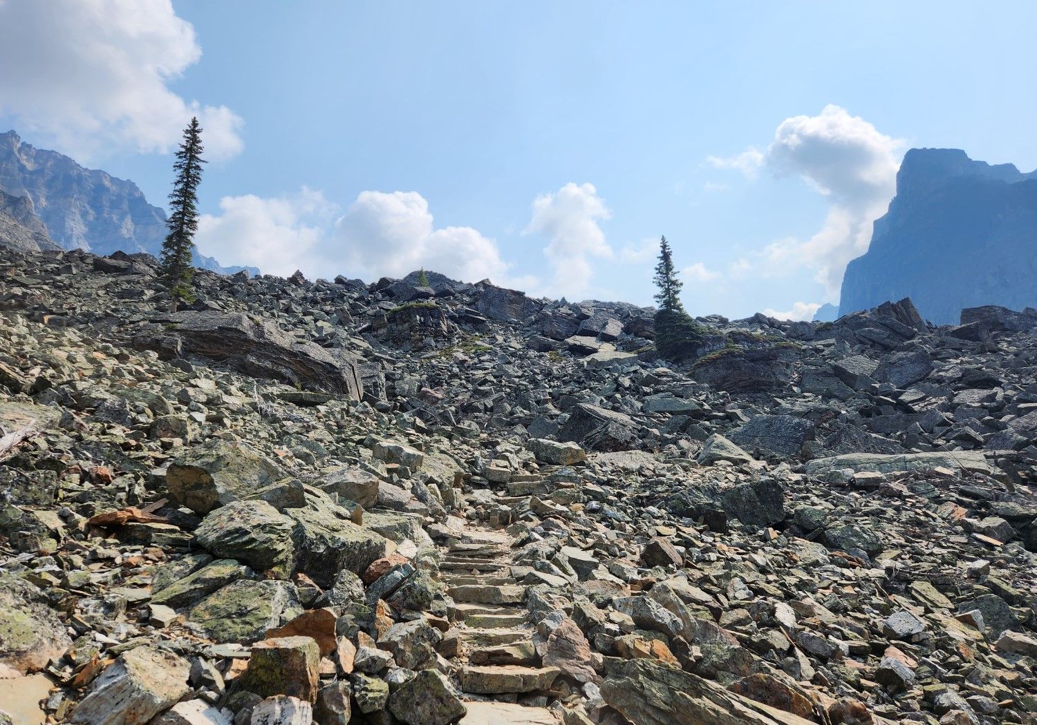
One wants to be careful when they walk on rocks. There is a path but it can be easy to lose. Thankfully this is the most popular trail in the Lake O'hara area so it's had a lot of work done on it.
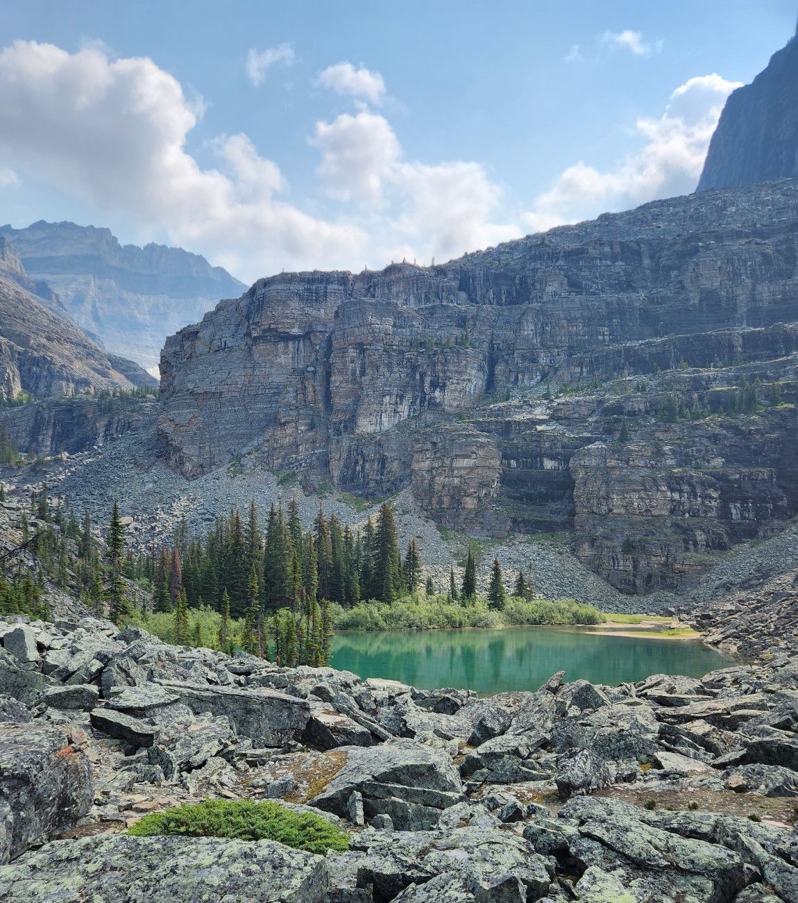
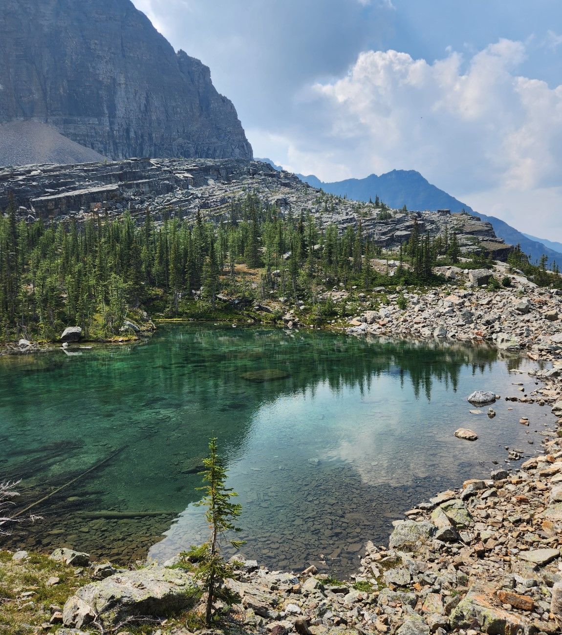
This is not Lake Oesa. It's called Yukness Lake, the ridge above it bears the same name as does the mountain above it to the right. We still have to go behind the ridge to get to our primary point of interest.
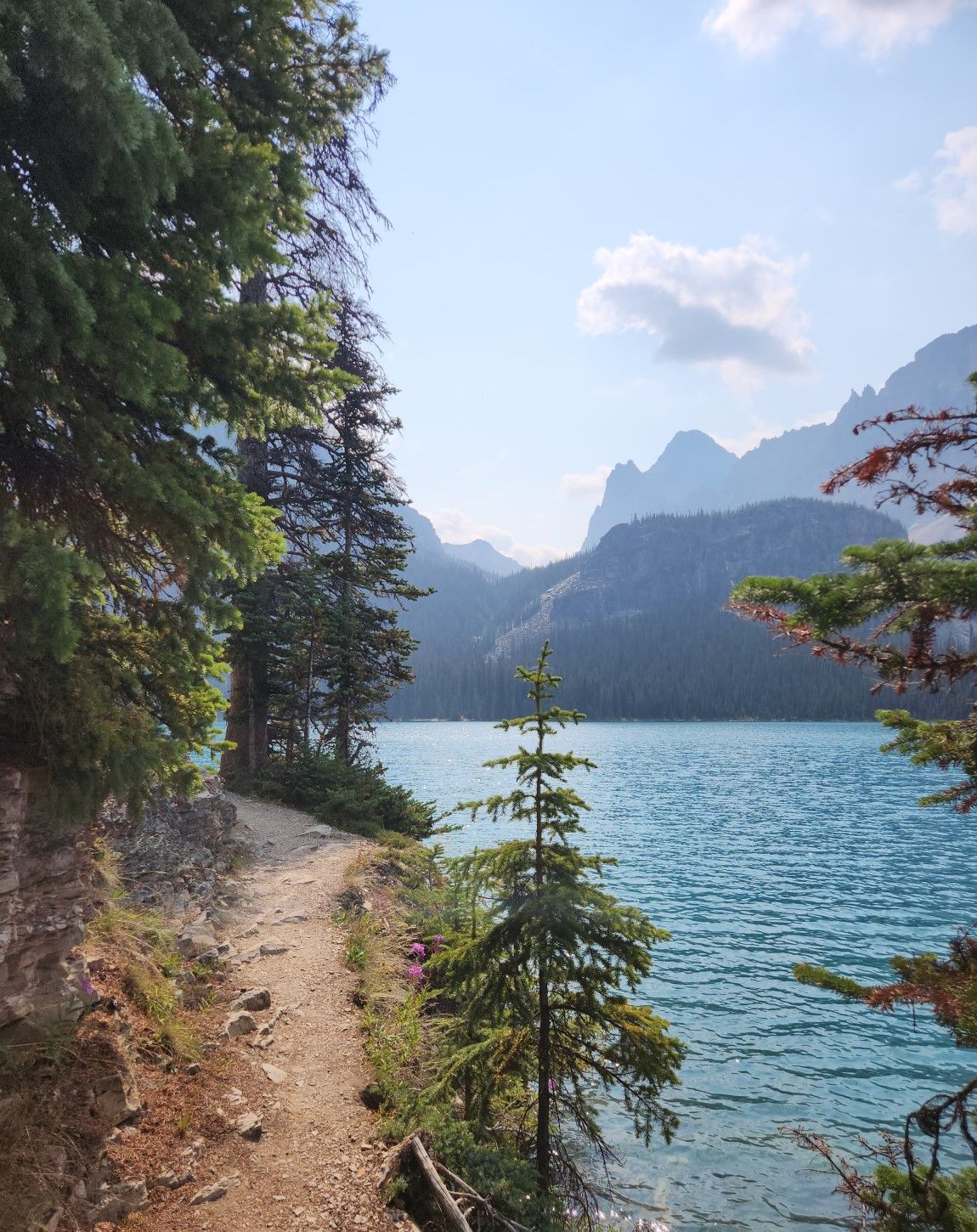
Water spills down the mountain, these parts of the Yoho National Park are wild and untouched by modernity. The best part of hiking here is that it's not crowded, unlike lake Louise which is about five kilometers east of here over mount Huber and Victoria.
If you look carefully you can see the trail up to Yukness ledge slowing working it's way up that rockslide. The scenery is just stunning, we took hundreds of photos this day.
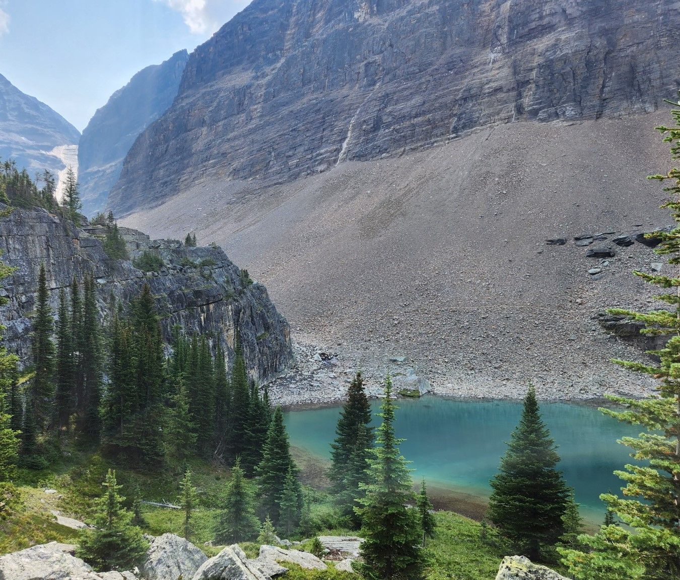
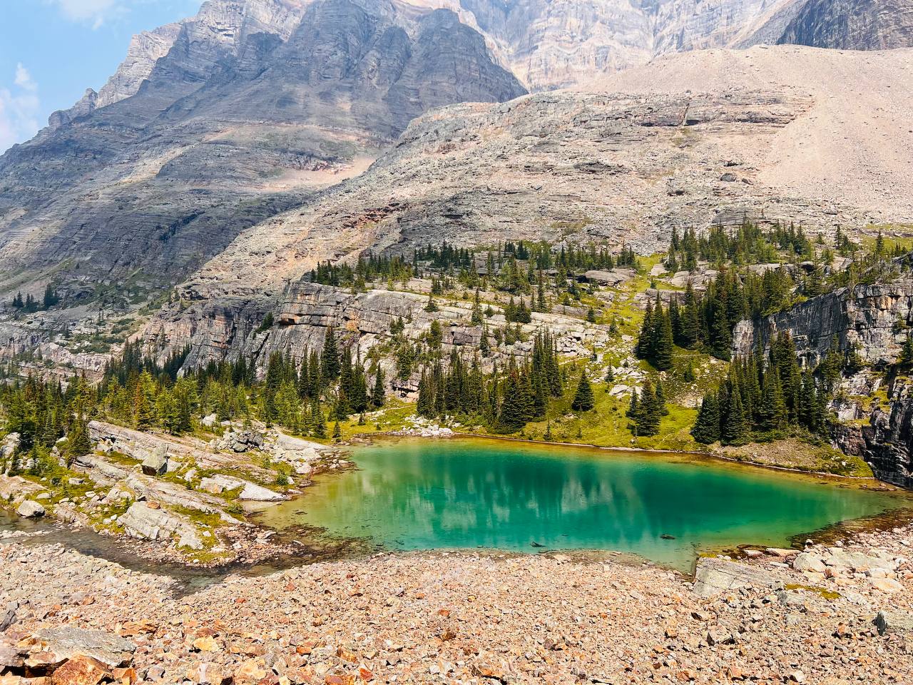
This too is not Lake Oesa, it's called Victoria Lake and is more of a pond than a lake. They're all connected to the same stream that originates from the glacier behind Lake Oesa.
This is Lefroy Lake, the colour is intense. The photo was taken after we reached Lake Oesa, it was nicer from this angle on the rockslide leading up towards Yukness ledge.
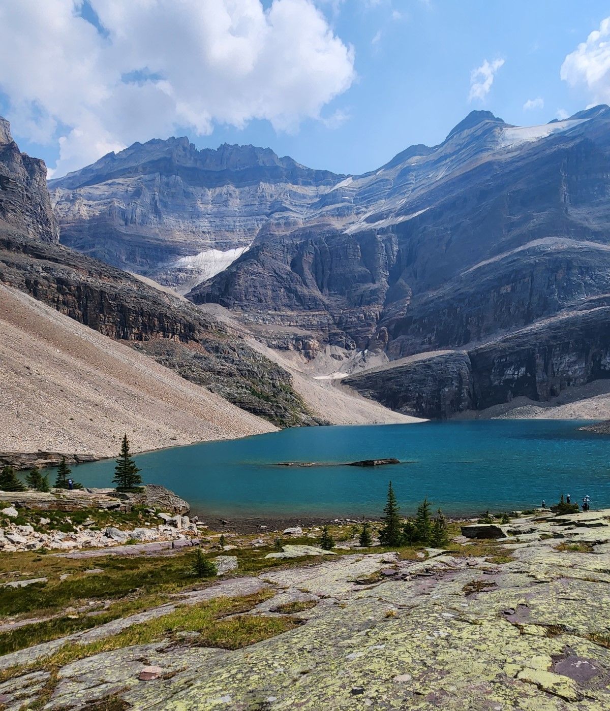
And finally we reached the famous Lake Oesa. Lucky are those who get the privilege of gazing upon this alpine beauty. We are in British Columbia, this water flows into the Pacific Ocean. On the other side of those peaks is Alberta, the water flows into the Arctic Ocean. There's a trail up to the left called Abbots Pass which will take you up to the 3400m peaks of Mount Victoria and Lefroy, it's not for the faint of heart.
Thanks for reading and hope you enjoyed the hike.

All photos taken with an iPhone 13 pro or an S22