English Version
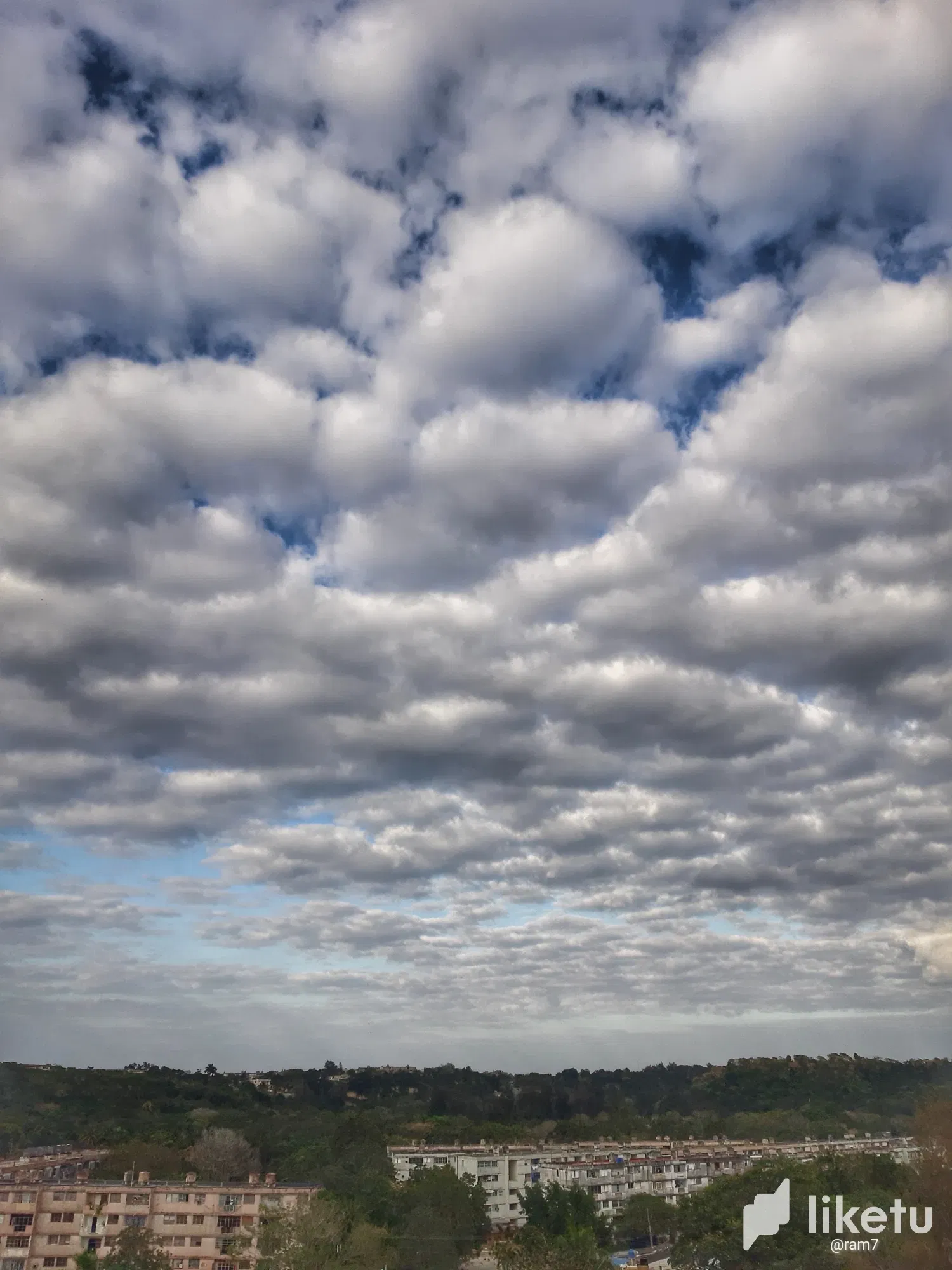
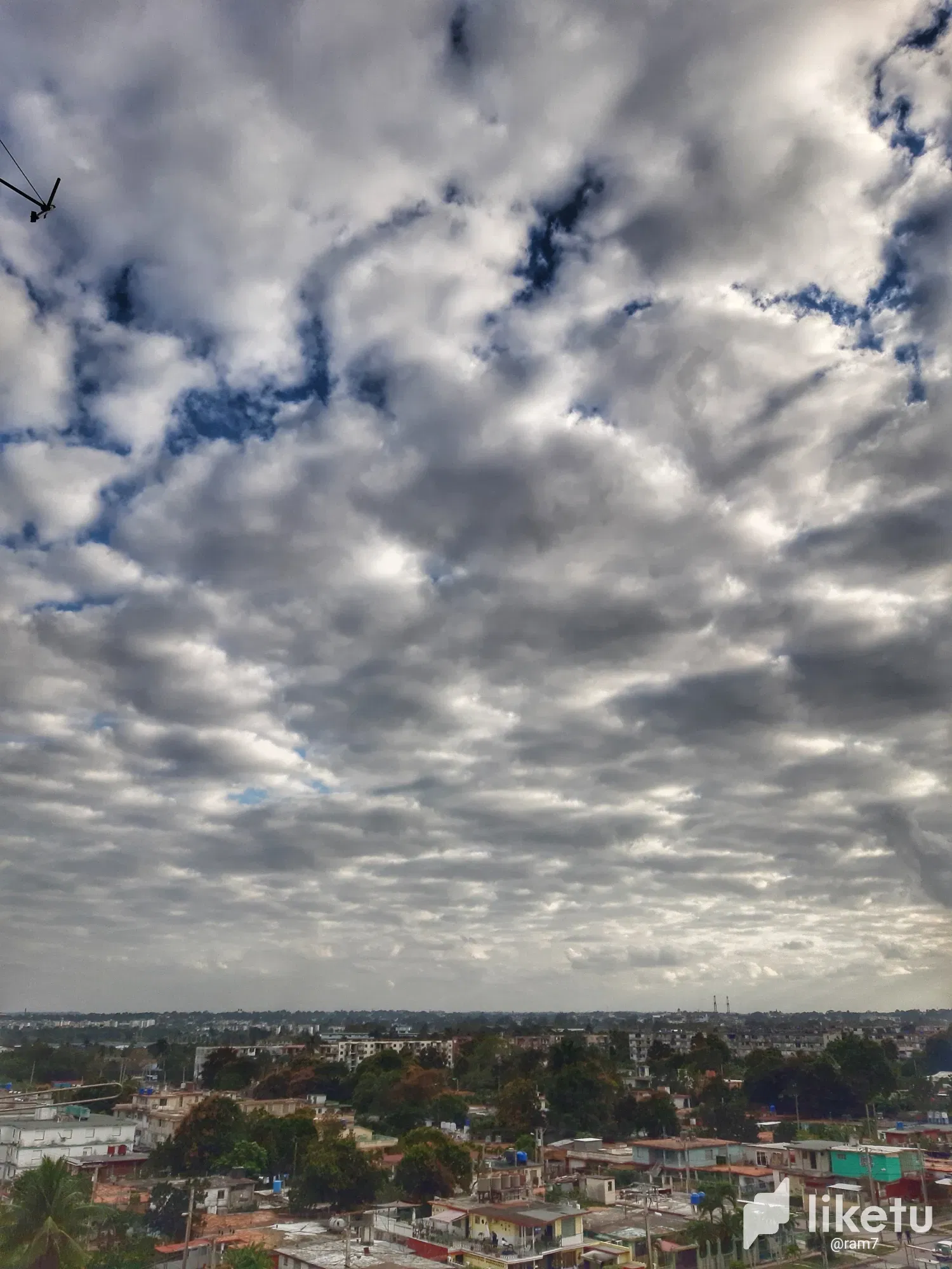
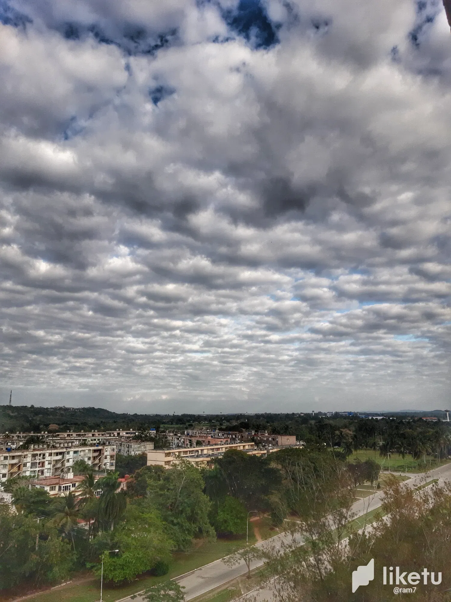
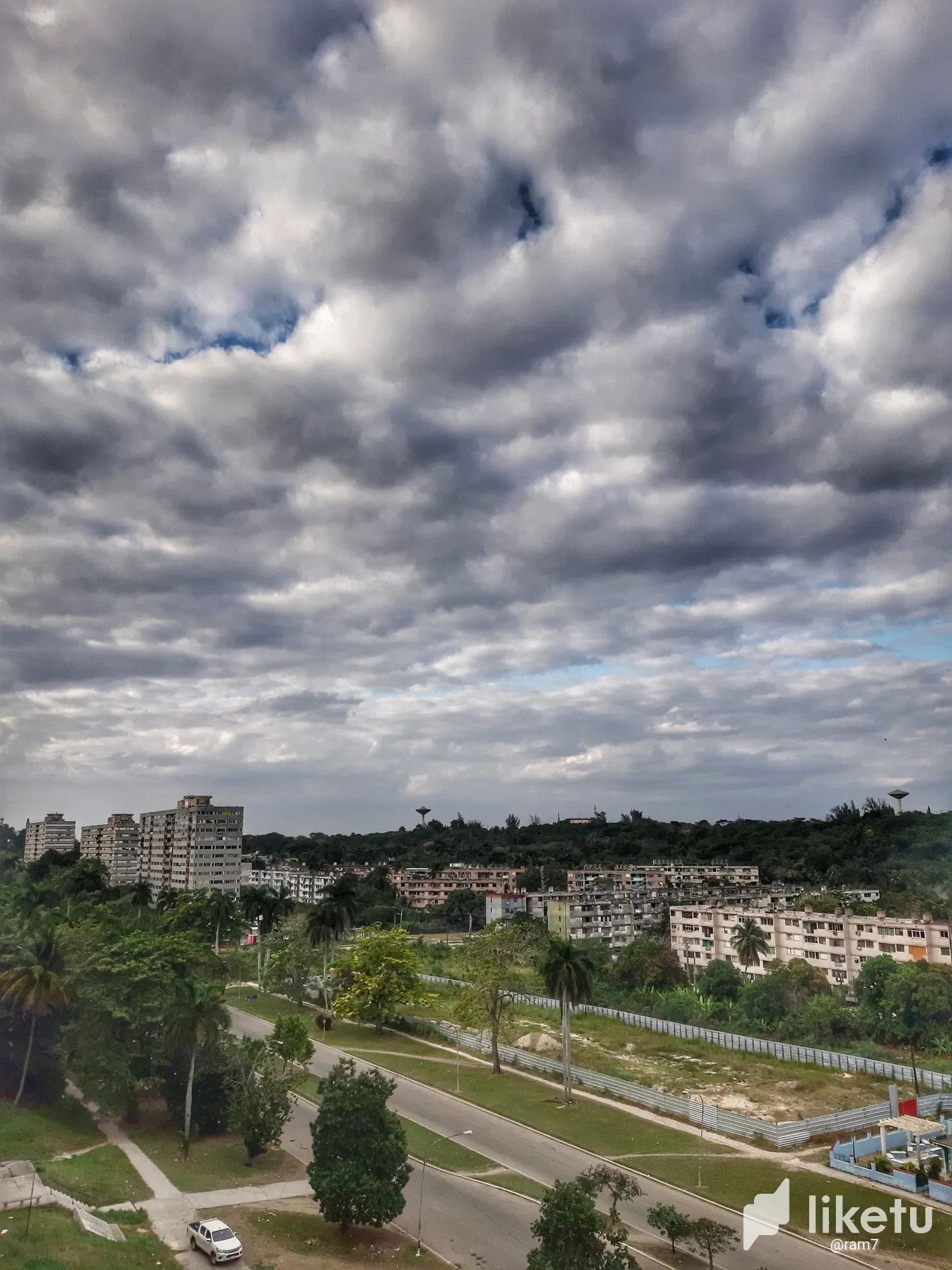
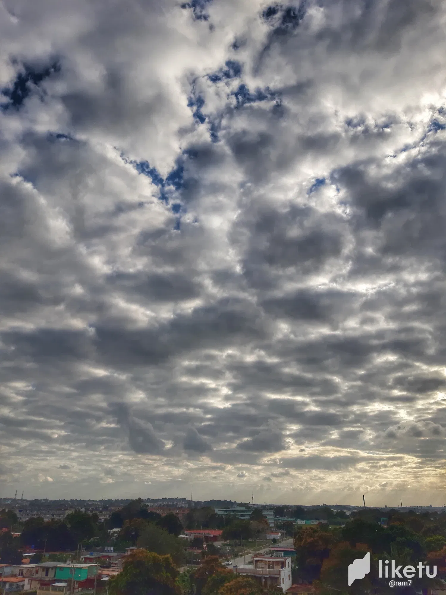
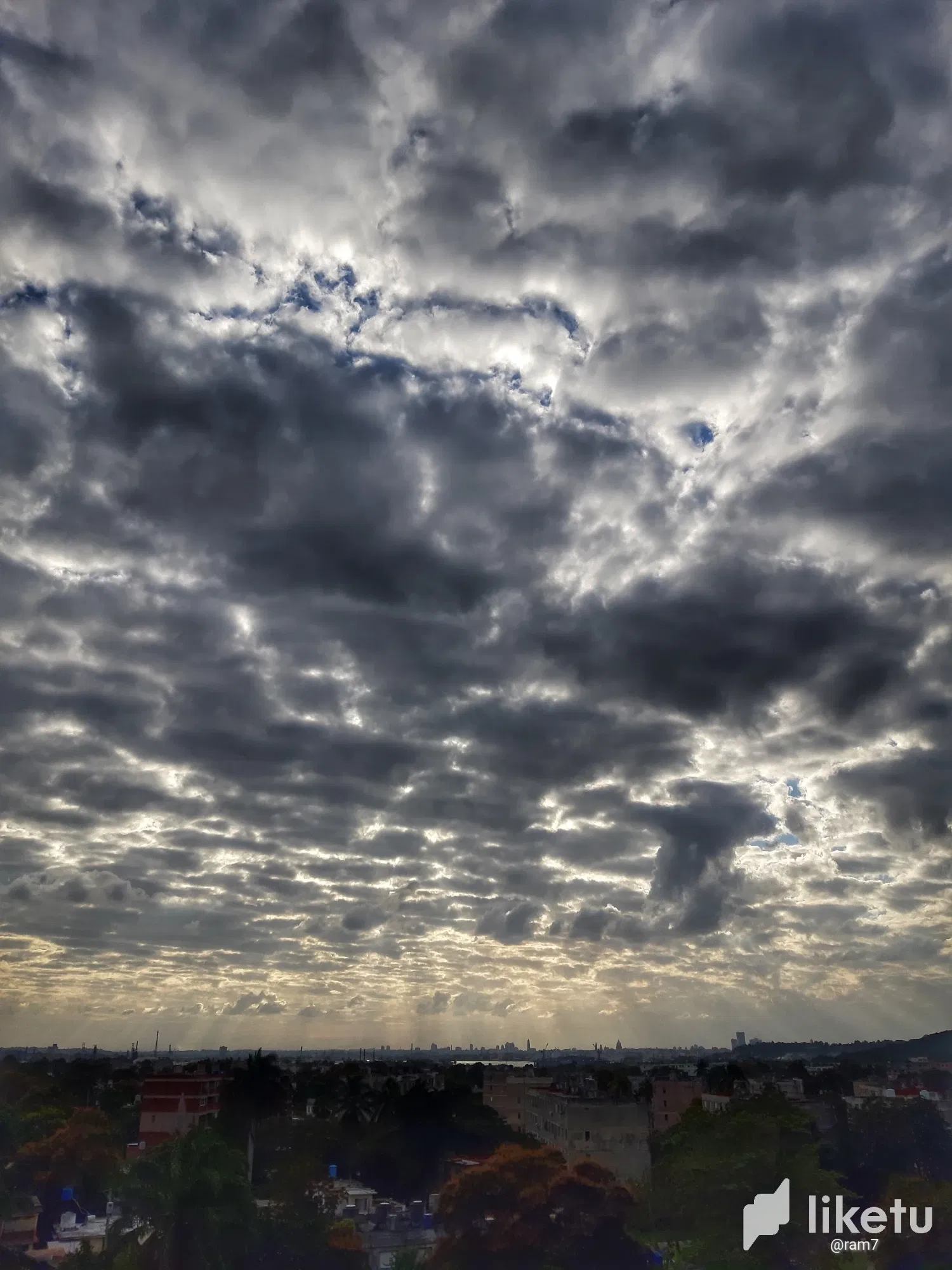
Stratocumulus clouds derive their name from Latin, and refers to their appearance in the form of cumulus clouds or patches of clouds that extend in a stratified or horizontal way covering large regions of the sky.
They originate in the lower levels of the atmosphere, generally below 2 km altitude. They do not produce rain, but may occasionally give off a light drizzle.
Their layered form is due to the water vapor contained in the air rising in weak updrafts, which condenses below a temperature inversion layer above which more stable air is situated. As a result, clouds "bump into" this layer and, unable to ascend any further, spread out horizontally. However, their presence is usually a harbinger of future weather changes due to the arrival of a frontal system or other meteorological phenomenon.
Well friends, I hope you have found it useful. Best regards again.
Versión en Español
Las nubes estratocúmulos derivan su nombre del latín, y hace referencia a su aspecto en forma de cúmulos o parches de nubes que se extienden de forma estratificada u horizontal cubriendo grandes regiones del cielo.
Se originan en los niveles bajos de la atmósfera, generalmente por debajo de los 2 km de altitud. No producen lluvias, pero sí pueden desprender en ocasiones una llovizna ligera.
Su forma estratificada se debe a que el vapor de agua contenido en el aire se eleva en débiles corrientes ascendentes, el cual se condensa debajo de una capa de inversión de temperatura por encima de la cual se sitúa aire más estable. Por ello, las nubes "topan" con esta capa, y al no poder ascender más se extienden de forma horizontal. Ahora bien, su presencia suele ser presagio de futuro cambio de tiempo debido a la llegada de un sistema frontal u otro fenómeno meteorológico.
Y bien amigos, espero les haya resultado provechoso. Saludos reiterados.

For the best experience view this post on Liketu